I am a computational data scientist working on geospatial AI and AI for science. In 2023 I proposed autonomous GIS: AI agents that find geospatial data, run spatial analysis, and make maps from plain-language requests. I build these agents, including LLM-Geo, LLM-Find, and GIS Copilot.
I also apply spatial data and machine learning to public health and cities, from hourly population estimates for U.S. neighborhoods to mosquito habitat prediction for malaria control. Before research, I spent more than ten years in the geospatial industry as an engineer, developer, manager, and chief technology officer.
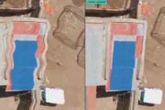
Correcting rolling-shutter "jello" distortion in drone images with an AI coding agent, and lessons on where the agent helps and where it still needs a human driver.
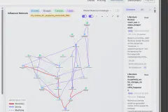
An AI copilot for human-AI research collaboration that frames grounded, testable hypotheses around a shared influence graph.
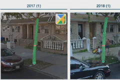
Measuring street tree trunks year after year in historical street view imagery to track how fast city trees grow.
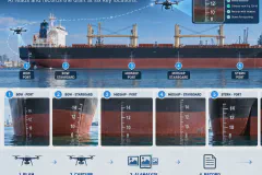
Drones photograph a cargo ship's draft marks and a vision language model reads them, cutting the inspection from more than an hour to about 15 minutes.
arXiv preprint arXiv:2504.01170 (2025)DOI
Annals of GIS (2025)DOI
International Journal of Digital Earth 18(1), 2497489 (2025)
International Journal of Digital Earth 18(1), 2458688 (2025)DOI